Academic Staff from outside Maths, Stats & Physics
Sara Marsham
Senior Lecturer and Marine Sciences Degree Programme Director
Vanessa Armstrong
Lecturer, School of Biomedical, Nutritional and Sport Sciences
Henny Mills
Degree Programme Director for Surveying and Mapping Science and Geographic Information Science, School of Engineering
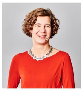 I studied German A- levels with specialisation in Maths and History. I always liked Maths at school as usually there is just one correct answer and the teacher cannot have his/her favourites.
When I finished my A-levels I wanted to study something with maths but not maths itself so I decided on Geospatial Engineering (also known as Surveying and Mapping). This was attractive to me as it involves maths, outdoor work and walking – all things that I enjoy! The work is often carried out in teams of 3 -5 students, for example, fieldwork in the Lake District so team work is also important in my work.
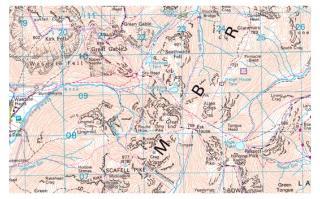 One example of work that a Geospatial Engineer might be interested in is mapping. For example, the Ordnance Survey originally mapped the UK in the 18th and 19th century using a technique which involves triangulating between markers on the ground called Trig Pillars. This created a map of the UK accurate up to 20m and all based on the use of angles and trigonometry back in 1801. Therefore, surveyors need to know error estimations as no map of the UK or any other is ever 100% accurate, as no measurement is perfect. In surveying we cannot measure the true value of a quantity that we are working with and therefore have to repeat measurements and analyse these. Some of the Maths and Stats in this type of work can be quite complex so having a strong foundation in Maths is really useful.
More recently you may have seen maps in the news relating to the current Coronavirus Pandemic. These maps are based on Geospatial data and allow the mapping, visualisation, monitoring and analysis of the virus and its spread. This is of course of critical importance in combatting the virus and containing its spread. There will be many Geospatial Engineers like me involved in working on the Geospatial data needed to create these maps of the pandemic right now.
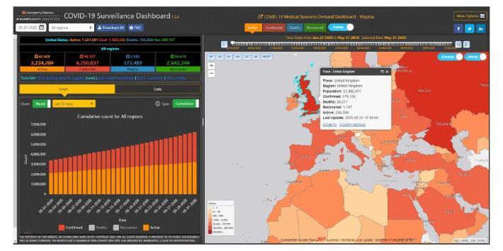
If you're interested in finding out more please visit our website: https://www.geospatialuk.org/
Laura Young
Reece Foundation Fellow, Biosciences Institute, Newcastle University
Gemma Roberts
Alzheimer's Society Clinical Fellow, Nuclear Medicine Physicist
Hannah Davis
Researcher and Lecturer in Animal Science/Agriculture, School of Natural and Environmental Sciences
Laura Heels & Becky Allen
Lecturer and PhD Student in Computing
This video has no audio content.


5-355x236.jpg)
